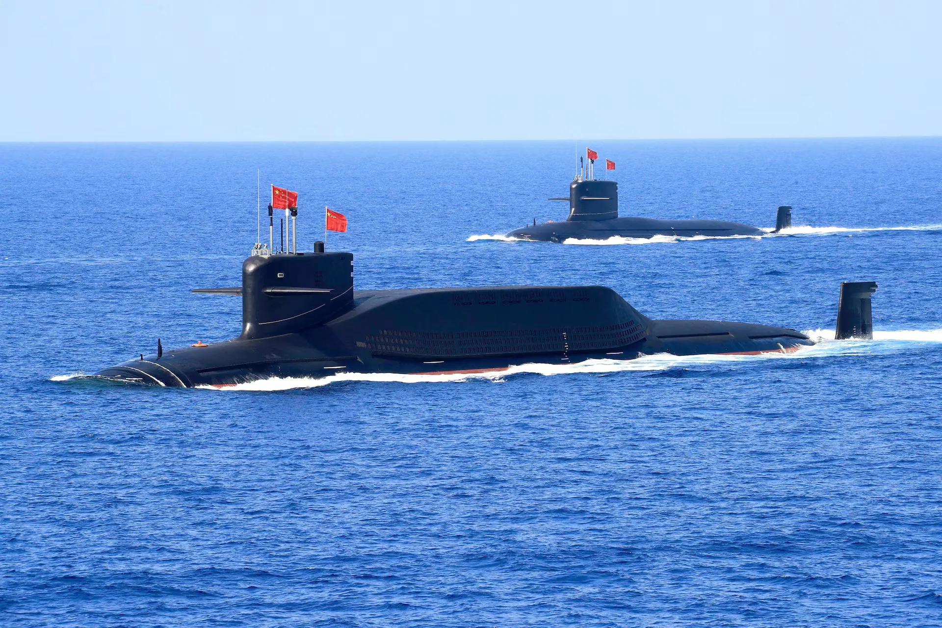
China is actively mapping the ocean to enhance its navy’s underwater capabilities

A large-scale ocean research programme
China is conducting a large-scale programme to map and monitor the ocean floor in the Pacific, Indian and Arctic Oceans. According to naval experts, this data could be crucial for conducting underwater warfare, reports Reuters.
Dozens of research vessels and hundreds of sensors are involved in the research. They collect information on seabed topography, water temperature, salinity and currents, which affect the movement of submarines and the propagation of sound waves.
One example is the Dong Fang Hong 3, which operated near Taiwan, Guam and in the Indian Ocean in 2024 and 2025. According to Chinese scientists, it carried out climate and geological research, but also conducted deep-sea mapping.
Combining scientific and military tasks
Some of the research is related to the search for mineral resources and fishing, but experts note that the data obtained also has military significance. It allows for better navigation in the underwater environment, the deployment of sensors and the more effective use of submarines.
According to experts, such research can help detect enemy submarines and conceal one’s own. In particular, the propagation of sound waves depends on the seabed topography and water characteristics.
Chinese vessels have been operating in areas near the Philippines, Guam, Hawaii and Wake Atoll, where US military facilities are located. The research also covers strategically important routes, including the approaches to the Strait of Malacca.
Expansion of research in various regions
China is actively exploring the Indian Ocean, which is a key supply route for resources from the Middle East and Africa.
Chinese vessels have also been conducting operations near Alaska and in the Arctic, which Beijing views as a strategic priority and plans to strengthen its presence there by the 2030s.
Experts note that such research indicates China’s desire to expand the capabilities of its navy and operate in remote maritime areas.
The ‘Transparent Ocean’ project
A separate initiative involves the creation of a system of underwater sensors, known in China as the ‘Transparent Ocean’. The idea involves deploying a network of devices to continuously collect data on water conditions and the movement of underwater objects.
Following its launch in the South China Sea, the project was expanded to the Pacific and Indian Oceans. Hundreds of sensors and buoys have been deployed there to record changes in temperature, salinity and water movement.
Chinese research institutions note that these systems provide data in near real-time, although experts point to technical limitations in such data transmission.
The strategic significance of the research
According to experts, the data obtained allows China to better understand the maritime environment in which it can operate both in peacetime and in the event of a conflict.
Particular attention is being paid to areas associated with the so-called First Island Chain, which restricts China’s access to the Pacific Ocean. Research in these waters, according to experts, may indicate an intention to expand access to the open ocean.
Chinese researchers also note that the results of this work could be used to develop new naval capabilities and strengthen defence capabilities at sea.